


About the region
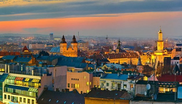
Ivano-Frankivsk is a nice cozy city in Western Ukraine. Such famous landmarks of Carpathians as The Rocks of Dovbush or Yaremche can be easily accessed from here. Besides, many people use Ivano-Frankivsk as a starting point for trips to the ski resort Bukovel.
The downtown is quite compact. You won’t have to travel by public transport, you can just walk. The streets are cozy and quiet, there are no broad avenues with lots of noisy traffic. In the first decade of the 2000s a lot of old buildings and squares were rebuilt.
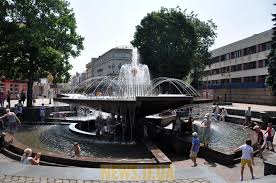
Fans of fountains will be pleased: Ivano-Frankivsk has at least two interesting fountains. The first one is a copy of Kyiv fountain on the Nezalezhnosti (Independence) Square, and the second one is built in the form of a huge bowl. You can stand under the fountain right behind the streams of water.

On the Market Square in the downtown you can find the City Hall. It was originally built in 1672 in the late Renaissance style, destroyed during the World War I and then rebuilt in 1929-1935.
Monument to the famous ukrainian beekeeper Peter Prokopovich.

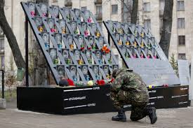
Memorial plate to the people who died in Kiev in 2014.
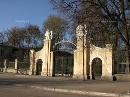
The city has Potocki palace, but it is in neglected state and located in the closed area. Only gate is restored.
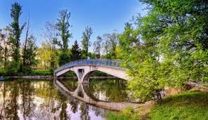
There is also a large lake with an island in Ivano-Frankivsk.
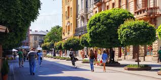
Nezalegnosti street (Independence) is a traditional for tourist pedestrian street.
Ivano-Frankivsk region is located in the west of Ukraine; in the northwest it borders on Lviv, in the northeast — on Ternopil, in the southeast — on Chernivtsi and in the southwest — on Zakarpatia region. In the south, it borders with Romania. The region was established on December 4, 1939, and it had been called Stanislav oblast by 1962.
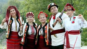
Ethnic groups of Hutsuls and Boykos live in the territory of Ivano-Frankivsk region.
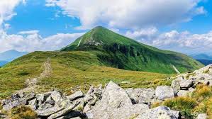
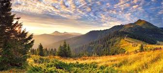
The landscape can be characterised by a great diversity. A considerable part of the region is located within physiographic zone of Carpathians, and its extreme southeastern part — within forest-steppe zone. By the nature of the relief, Ivano-Frankivsk region is divided into three parts. In the north, there is the Podolian Upland (up to 430 m). On the Dnister right side, there is the Subcarpathian lowland (Pokutska lowland, Voinyliv and Pryluky uplands, Bystrytska, Kaluska and Rozhniativ hollows, Maydanske lowland and others). Almost the half of the territory of the region is occupied by the Carpathians. In the south of the region, there are the Hryniavy and Chyvchyny mountains. The highest peak of Ukraine — Mountain Hoverla (2061 m).
The climate of the region is continental. In the Subcarpathia and the Podolian upland, winter is mild, summer is warm, the average temperature of January is -5º, of July — +19º. The period with the temperature of +10º lasts for 155-170 days, the frost-free period — for 150-155 days. In the mountains, the climate is much more severe — the higher you are, the colder it is. In average, the temperature shift is -0,5º at an altitude of 100 m. In the mountains, snow covering lasts from the beginning of November to May, its thickness is more than 60 sm. at an altitude of 650 m. There are downpours, hail, blizzards, glazed frost, fogs and frosts among adverse climatic phenomena. If you are getting ready for a trip, take into account the difference in the climate — warm clothes and boots may be useful even in summer.
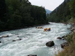
8586 rivers flow through the territory of the region. They belong to the Dnister and Prut basins. There are such right tributaries of the Dnister within the region: the Svicha, the Limnytsia and the Bystrytsia; and left ones as the Svir and the Hnyla Lypa. Right tributaries of the Prut are the Cheremosh, the Rybnytsia, the Pistynka and the Liuchka; left ones are the Turka, the Chorniava and the Beleluya. The rivers are in a large part fast flowing, they create cascades and waterfalls that are very important for water tourism. There are few lakes here, among mountains— Brebeneskul, Lebedyne and Nesamovyte.
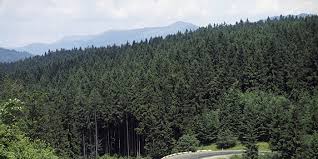
Ivano-Frankivsk region is one of the richest in forests in Ukraine. In the plain and foothills, they occupy 30% of the territory (hornbeam, oak and beech prevail), on the slopes of the Carpathians — 60% (at an altitude of 800-1000 m – beech, fir tree, spruce and silver fir; up to 1500 m — spruce, fir tree, Swiss and mountain pine). At the altitudes of more than 1500 m, you can find subalpine meadows (polonynas).
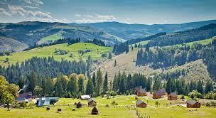
It is the land of natural reserves. In the territory, there are 438 reserves and protected objects of the total area of 186,5 thousand hectares. The part of the mountain territory of the area of 503 km2 belongs to National Park “Karpatsky”.
In Ivano-Frankivsk region, there are possibilities for a lot of kinds of tourism: cultural and historical (Halych, Kolomyia, Rohatyn, Ivano-Frankivsk), patriotic (museums, bunkers and tours in places of military glory of the UPA (the Ukrainian Insurgent Army), rural green, equestrian, water, adventure, ski-tourism and many others. Favorable climate, mineral waters and therapeutic peat muds belong to natural recreational resources of the region. Among resorts, there are such low-mountain ones as Yaremche, Tatariv, Mykulychyn, Myslivka, Novy Mizun, Sheshory, high-mountain ones as Vorokhta and Yablunytsya as well as a balneo-mud foothill resort ‘Cherche’.
Mineral waters
In the mountainous part, there are chloride-sodium mineral waters, near the village of Sheshory — mineral water.

The most famous Ukrainian ski resort Bukovel is also located in Ivano-Frankivsk region.

Walk around the old cities of Ivano-Frankivsk and Kolomyia.
At the shepherds’ houses, taste fresh bryndza (kind of sheep cheese) and Hutsul cuisine.
Take a photo in Hutsul clothes.
At the workshops, learn to weave Hutsul woolen blankets, sculpt Kosiv ceramics or make motanka-dolls (Ukrainian dolls made of natural fabrics and materials, including straw, grain, clay, flax, wool and even corn, and put together with the use of knots).
In winter — go skiing, in summer — go camping or ride a horse,walking, cycling or bus excursions, rafting along mountain rivers.
R. Kumlyk Museum
Nature of Halych Land
History museum of ancient Halych
Hutsulshchyna and Pokuttya Folk Art Museum
Museum Of Folk Art Of Hutsul
Vyhoda NGR Heritage Centre
Easter eggs painting museum
Museum of Ethnography and Mode of Life
Art Museum
High-mountain observatory on Mount Pip Ivan, Verkhovyna district
Villa Cedar Chamber, the village of Osmoloda
Church of the Immaculate Conception of the Bl. Virgin Mary and cells (1769), the city of Horodenka
Manyava Skete
Pniv Fortress
Church of the Nativity of the Virgin (ХVІІ-XVIII cent.), the urban village of Vorokhta
Church of the Nativity of Jesus (ХІІІ-XV cent.), the city of Halych
Сhurch of St. Panteleymon (XII cent.) with a belfry, the village of Shevchenkove
Church of the Holy Spirit, the city of Rohatyn
Nature Reserve “Gorgany”
Mud volcano, the village of Starunia
Dnisterskyi regional landscape park
Zhenetsky Waterfall, the village of Tatariv
Manyava Waterfall
Dovbush Rocks, the city of Yaremche
Here you can celebrate religious holidays.

- V. Virastyuk, the strongest person in the world in 2004 and 2007, was born in Ivano-Frankivsk.
- The most highly located place of work and scientific institution in Ukraine — Biological Station of Lviv branch of the Botany Institute of NASU (the National Academy of Sciences of Ukraine) — is located on polonyna Pozhyzhevska (1429 metres above sea level). It includes Weather and Snow Stations. It was built in 1899. Polonyna Pozhyzhevska is also the wettest — 1593 mm Hg of annual precipitation — and the windiest place in Ukraine — the wind at a speed of more than 15 m/s (54 km/h) blows here in average for 120 days annually.
- The village of Mykulychyn is considered to be the longest one in Ukraine — it stretches for 24 km, at first — along the road, then — into the mountains.
- The village of Kosmach, so-called ‘Hutsul capital’, is the largest village by area in Europe.
- One of the largest stone railway bridges in Ukraine is located in Vorokhta, it was built in 1895. Its total length is 130 m while the vault is 65 m. The bridge is not in use nowadays.
- The most highly located construction is considered to be the ruins of Meteorological and Astronomical Observatory on Mount Pip Ivan (2028 m).
- The largest plateau is located in the Chyvchynski mountains at an altitude of 1750 metres above sea level in the form of the flat top of Mount Palenytsia.
- The most high-altitude lake is Brebeneskul that is located on the slopes of Mount Hutyn-Tomnatyk at an altitude of 1801 m, it is 134 m in length and 44 m in width, its square is 4000 m2 and its maximum depth is 2,8 m.
- The highest subalpine hollow bog is located in the saddle between polonynas Breskul and Pozhyzhevska at an altitude of 1800 m that appeared in glacial cirques because of water-logging of lakes. The bogs in Ozerne (1750 m) and at the foothill of Mount Brebeneskul (1700 m) also belong to these kinds of bogs.
- Hanging bogs are considered to be the most unusual ones, they often ‘nestle’ on the mountain slopes. The largest of them — Hlystove bog — is located on the southern slope of the polonyna of the same name in the Hryniavski mountains at an altitude of 1450 m.
- The most high-altitude tree is mountain pine, it is found on the slope of Mount Pip Ivan Chornohorskyi at an altitude of 2010 metres above sea level. It is unpretentious, has wide ecological amplitude, it can grow on dry rocky cliffs and in placers with undeveloped layer of soil. It shows 2-4 m high krumholtz formation or 20-30 cm high small dwarf specimens.
- In 1907 near the village of Starunia, animal remains of the end of the Ice Age were found by accident. In the ozokerite mine at a depth of 12,5 m, a mammoth was found, and a bit deeper — a woolly rhinoceros, a megaloceros, different birds and amphibians. Obviously, salt, ozokerite, solution of petroleum and oxygen-free conditions of mud contributed to the preservation of animals. By radiobiological method, the rhinoceros was discovered to have been lying here for 23255 ± 775 years.
- Near the village of Starunia, a unique mud volcano of anthropogenic origin is located. It responds to earthquakes that occur within a radius of 3-6 thousand km in Romania, Italy, Germany, Iraq, in the Caucasus and even in Soviet Central Asia. This permanently active underground ‘barometer’ is a unique place for exploring peculiarities of the dynamics of the earth.
Ландшафт дуже різноманітний. Значна частина області розташована в межах фізико-географічної зони Карпат, а її крайня південно-східна частина – в межах лісостепової зони. За характером рельєфу Івано-Франківська область ділиться на три частини. На півночі – Подільська височина (до 430 м). На правому боці Дністра – Підкарпатська низовина (Покутська низовина, Войнилівська і Прилуцька височини, Бистрицька, Калуська і Рожнятівська низини, Майданські низовини та інші). Майже половину території області займають Карпати. Їх розділяють поперечні і поздовжні долини на гірські масиви і ділянки, що тягнуться на південний схід – Горгани і Покутсько-Буковинські Карпати. На півдні області знаходяться Гриняви і Чивчинські гори, а також Чорногірський хребет, де знаходиться найвища вершина України – Гора Говерла (2061 м).
Клімат регіону континентальний. У Прикарпатті та Подільському узгір’ї зима м’яка, літо тепле, середня температура січня – 5º, липня – + 19º. Період з температурою + 10º триває 155-170 днів, безморозний період – 150-155 днів. У горах клімат набагато жорсткіший – чим вище ви, тим холодніше. У середньому, температурний зсув становить -0,5º на висоті 100 м. У горах сніжне покриття триває з початку листопада по травень, його товщина більше 60 см. на висоті 650 м. Серед несприятливих кліматичних явищ є злива, град, хуртовини, засклені морози, тумани та морози. Якщо ви готуєтеся до поїздки, врахуйте різницю в кліматі – теплий одяг і чоботи можуть бути корисні навіть влітку.
По території області протікає 8586 річок. Вони належать до басейнів Дністра та Пруту. У регіоні є такі права притоки Дністра: Свіча, Лімниця і Бистриця; і залишилися такі, як Свір і Гнила Липа. Правими притоками Пруту є Черемош, Рибниця, Пистинка і Лючка; ліві – Турка, Чорнява і Белелуя. Річки в значній мірі швидко протікають, вони створюють каскади і водоспади, які дуже важливі для водного туризму. Тут є кілька озер, серед гір – Бребенескул, Лебедин та Несамовите.
В Івано-Франківській області найбагатші ліси України. У рівнині і передгір’ях вони займають 30% території (переважно граб, дуб і бук), на схилах Карпат – 60% (на висоті 800-1000 м – бук, ялина, ялинка, ялиця) до 1500 м – ялина, ялинка, швейцарська і гірська сосни). На висотах понад 1500 м. можна знайти субальпійські луки (полонини).
Це земля природних заповідників
На території знаходиться 438 заповідників і об’єктів, які знаходяться під охороною. Загальна площа складає 186,5 тис. га.
Частина гірської території площею 503 км2 належить Національному парку «Карпатський».
У Івано-Франківській області є можливості для безлічі видів туризму: культурно-історичний (Галич, Коломия, Рогатин, Івано-Франківськ), патріотичний (музеї, бункери і екскурсії по місцях військової слави УПА (українська) Повстанська армія), сільський зелений, кінний, водний, пригодницький, гірськолижний туризм та багато інших сприятливий клімат, мінеральні води і лікувальні торф’яні бруди належать до природних рекреаційних ресурсів регіону, серед курортів – такі, як Яремче. , Татарів, Микуличин, Мислівка, Новий Мізунь, Шешори, високогірні Ворохта і Яблуниця, а також бальнеогрязький передгірний курорт Черче.
Мінеральні води
У гірській частині знаходяться хлоридно-натрієві мінеральні води, вуглецеві води низької мінералізації, біля села Шешори – мінеральна вода.
Найвідоміший український гірськолижний курорт Буковель також розташований в Івано-Франківській області.
Що потрібно робити в Закарпатті
Відвідайте цікаві пам’ятки архітектури – переважно дерев’яні церкви. Також можна прогулятися навколо старих міст Івано-Франківська та Коломиї. У пастирських будинках скуштуйте свіжу бринзу (вид сиру, який виготовляється з козиного молока ) і гуцульську кухню. Сфотографуйтеся в гуцульському одязі. В майстернях, можна навчитися плести гуцульські вовняні ковдри, ліпити косивську кераміку або робити ляльки- мотанки (українські ляльки з натуральних тканин і матеріалів, у тому числі соломи, зерна, глини, льону, вовни і навіть кукурудзи, зроблена з використанням вузлів). Взимку – кататися на лижах, влітку – відправитися в похід або покататися на конях, пішки, велосипедні або автобусні екскурсії, сходити по гірських річках.
Найцікавіші музеї
“Бойківщина”. Музей Р. Кумлика. Історичний музей стародавнього Галича. Музей народної творчості гуцульщини та покуття. Музей народного мистецтва гуцульщини. Виставковий центр “Вигода НГР”. Музей живопису писанок. Музей етнографії та побуту. Музей мистецтв.
Найбільш цікаві пам’ятки архітектури
Благовіщенська церква (1587 р.), обсерваторія на горі Піп Іван, церква непорочного зачаття Бл. Діви Марії (1769), Манява Скит, Пнівська фортеця, церква Різдва Богородиці (ХVІІ-XVIII ст.), церква Різдва Ісуса (ХІІІ-ХV ст.), церква св. Пантелеймона (XII ст.), церква Святого Духа.
Найцікавіші природні пам’ятки
Високогірне озеро Несамовите, Чорногірський хребет, заповідник “Горгани”, грязьовий вулкан, регіональний ландшафтний парк Женецкий водоспад, водоспад Манява, скелі Довбуша, Тисовий заповідник, заповідна територія Лебедин.
Село Микуличин вважається найдовшим в Україні – тягнеться на 24 км, спочатку – по дорозі, потім – у гори. Село Космач, так звана «гуцульська столиця», є найбільшим селом за площею в Європі. Один з найбільших кам’яних залізничних мостів в Україні розташований у Ворохті, він був побудований в 1895 році. Його загальна довжина – 130 м. Міст зараз не використовується. Найбільш високо розташованою спорудою вважаються руїни метеорологічної та астрономічної обсерваторії на горі Піп Іван (2028 м).
Найбільше плато розташоване в Чивчинських горах на висоті 1750 метрів над рівнем моря у вигляді плоскої вершини гори Паляниця. Найбільш висотним озером є Бребенескул, яке розташоване на схилах гори Гутин-Томнатик на висоті 1801 м, він становить 134 м. в довжину і 44 м. в ширину, його площа становить 4000 м2, максимальна глибина – 2, 8 м. Найбільше субальпійське порожнє болото розташоване в сідлі між полонинами Брескул і Пожижевською на висоті 1800 м. До таких боліт відносяться також болота в Озерні (1750 м) і в передгір’ї гори Бребенескул (1700 м).
Найбільш незвичайними вважаються висячі болота, які часто «притискаються» до гірських схилів. Найбільше з них – Глистівське болото – розташоване на південному схилі полонини в Гринявських горах на висоті 1450 м. Найбільш висотне дерево – гірська сосна, воно знаходиться на схилі гори Піп Іван Чорногорський на висоті 2010 метрів над рівнем моря. Дерево невибагливе, має широку екологічну амплітуду, може рости на сухих скелястих обривах і в розсипах з нерозвиненим шаром грунту.
